Marketplace
-

Cloud price calculator
Open Telekom Cloud price calculator…
Service provider: T-Systems
Usage field: Cloud Infrastructure & Applications -
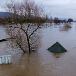
Flood Detection
The developments are based on the requirements of insurance companies, which rely on up-to-date information on the location, intensity and duration of floods for a quick response to flood-related damage events.
Service provider: ConTerra
Usage field: Land, Agriculture -
Open Telekom Cloud
The Open Telekom Cloud is a public Cloud from Deutsche Telekom that is managed by T-Systems..
Service provider: T-Systems
Usage field: Cloud Infrastructure & Applications -
Polar TEP
The Polar Thematic Exploitation Platform (Polar TEP) provides a complete working environment where users can run analytics on EOPORT data in Near Real Time
Service provider: Polar View
Usage field: Cloud Infrastructure, EO Tools -
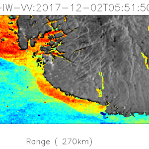
SAR OCEAN RADIAL VELOCITY
The SAR ocean radial velocity illustrates ocean currents by providing an estimate of the radial velocity.
Service provider: The Norwegian Research Centre (NORCE)
Usage field: Marine -
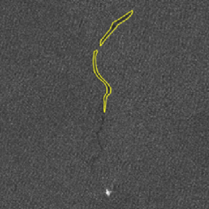
SAR Oil Spill detection
Oil spill detection over your defined Area Of Interest using Sentinel-1 data – a service offered by GMV
Service provider: GMV
Usage field: Marine -
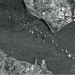
SAR Vessel detection
The SAR Vessel detection service is working directly on the SAR data stream and can output detected vessels even while the imagery is still being downlinked from the satellite to the ground station.
Service provider: KSAT
Usage field: Marine -
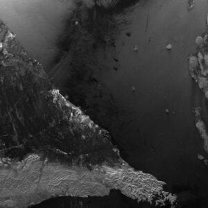
Sentinel-1 GeoTIFF
Work with Sentinel-1 GeoTIFF files only seconds or minutes from sensing time. Image segemtns ready for exploitation in parallel to satellite transfer to ground station.
Service provider: Kongsberg Defence & Aerospace AS
Usage field: Agriculture, Land, Marine, EO Tools -
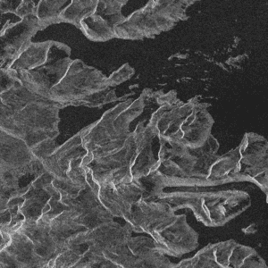
Sentinel-1 NRT-SAR GRD
The Sentinel-1 NRT-SAR service provide SAR segments for exploitation by EOPORT services within seconds.
Service provider: Kongsberg Defence & Aerospace AS
Usage field: Agriculture, Land, Marine, EO Tools -
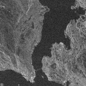
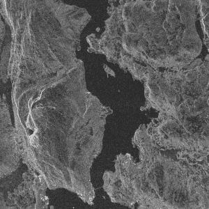
Sentinel-1 Quicklook Images
Sentinel-1 QuickLook images ready within minutes from acquisition at a ground station.
Service provider: Kongsberg Defence & Aerospace AS
Usage field: QuickLook images -
Sentinel-1 SAFE Products
Service offering Sentinel-1 SAFE formatted Level-1 GRD products that cover a customer defined AOI.
Service provider: KSAT
Usage field: EO Tools -
Suomi NPP Quicklook Images
This service allow you to subscribe to QuickLook images from the Suomi NPP satellite.
Service provider: Kongsberg Defence & Aerospace AS
Usage field: Image -
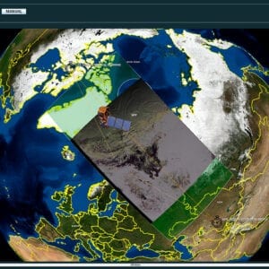
VideoWall service
Live view of satellite data – watch quick-look images on a digital earth as they are being received at a ground station.
Optical and SAR imagery displayed in NASA WorldWind in Near Real Time
Service provider: Kongsberg Defence & Aerospace AS
Usage field: EO Tools